Circa 1828
Map Drawn by Stephen F. Austin
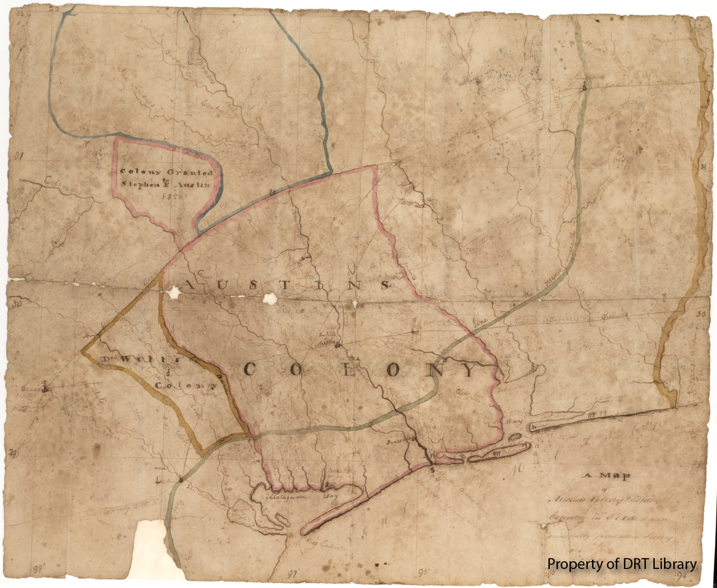
This is an early example of one of Stephen F. Austin’s hand-drawn Texas maps, the title of which is A Map of Austin's Colony & Adjacent Country in Texas Drawn Principally from Actual Survey by Stephen F. Austin. It is undated but is suspected to have been drawn around 1828. The map is based on Mexican cartographic efforts and information provided by surveyors and residents.
The map was part of the papers of the Cumings family, who were among the first group of settlers in Austin’s colony. Rebekah Russel Cumings and three of her sons received land grants in the colony. One son, James Cumings, received a five-league grant in return for a pledge to construct a mill in what is now Austin County. The map along and other Cumings family documents were donated to the Daughters of the Republic of Texas in 1996 by Elizabeth Anne Paul, a member of the family.
The original drawing is part of the DRT Library Collection at Texas A&M-San Antonio.